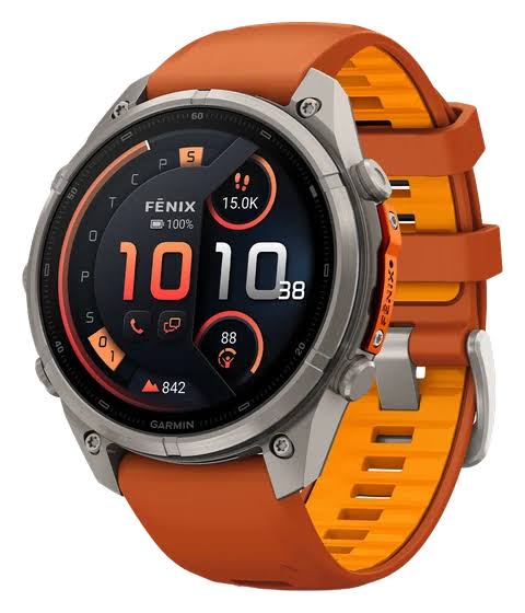
I just took a Garmin Fenix 9 on a two day, one night trek through a forest route, and the navigation on it genuinely surprised me. Out there with no phone signal, having detailed offline maps and multi-band GPS on my wrist was my lifeline.
What do offline maps actually give you deep in the forest?
I felt a lot more settled carrying the Garmin Fenix 9 far into the mountains, where there’s no phone signal and no internet. Being able to load TopoActive maps onto the Garmin watch beforehand meant I could see the terrain for what it was, right on my wrist.
The detail on the Fenix 9 is noticeably better than before. The screen renders every contour line, every switchback and the patches of vegetation clearly. The brightness also beat the midday sun, so I could read everything on it without squinting.
The processor responds well enough that zooming the map in and out happens instantly. The lag from the older generation is gone, which made it quick to check where I was and look ahead at the route.
Is the GPS lock and the navigation as accurate as Garmin claims?
On this climb, stretches under heavy tree cover and sheer rock faces were unavoidable. The Garmin watch still held up in the places where ordinary devices drop their position fix.
Multi-band reception, and how fast it locks on
The big upgrade on the Garmin Fenix 9 is the advanced multi-band GNSS positioning. To me the Fenix 9 is a real jump forward here, because it picks up GPS in a few seconds.
Because it holds the signal continuously, the Garmin Fenix 9 stuck to the tracklog remarkably closely the whole way. It stayed stable even crossing dense, awkward forest terrain.
NextFork map guidance
Another upgrade worth having on the Garmin Fenix 9 is NextFork. I found it useful: it shows at a glance how far it is to the next junction.
It also gives you the name of the trail coming up, which makes working out your direction easier. The smartwatch lays the data out clearly, and that makes navigating with the Fenix 9 feel safer.
What does combining offline maps with GPS change?
The Garmin Fenix 9 works well because the positioning system and the offline maps work together. That combination makes it reliable on trips out, so you can explore without worrying about getting lost.
Over the two days and one night, the maps and positioning on the Fenix 9 changed a number of things for the better:
• Positioning on the Garmin Fenix 9 makes working out your direction easier, with no phone and no mobile network involved.
• Off-course alerts reach Garmin watch users quickly, with almost no delay, so you get back on the tracklog right away.
• Navigation stayed smooth and steady across the whole trip, because the battery holds out, and that was reassuring.
From where I sit, the Garmin Fenix 9 is an upgrade worth paying for. The offline maps and the navigation on it were accurate enough to keep me settled through that trip. With all of this, are you ready to put your money down for one?
Garmin fēnix® 9, Titanium, 43mm, Pebble Gray: Check Availability on Amazon
Garmin fēnix® 9, DLC Titanium, 51mm, Carbon Gray/Black: Check Availability on Amazon
Garmin fēnix® 9, DLC Titanium, 47mm, Carbon Gray/Black: Check Availability on Amazon
Garmin fēnix® 9, Titanium, 47mm, Pebble Gray: Check Availability on Amazon
Related Posts


